This makes you wonder not only what wheels to take but what bike to take - road or TT??? As for the run it looks like grappling irons may be a prerequisite straight out of T2.
Oh well ay, it's the same for everyone I guess, glad I changed my biking route to the hilly Broga loop last week and from now on my 32k long run will incorporate double hill too.
It's all gonna hurt, even more than usual. *sob sob*
 CLICK TO ENLARGE
 CLICK TO ENLARGE

11 comments:
Stop moaning....at least 40km of each 90km lap of the bike are down hill.....
The run my lumpy...but the change in elevantion is akin to running round you housing estate (is that what they're called in KL!!!)
wow man. So this brings up the question, do you change your gearing to allow for better climbing? I don't know anything about bikes but have seen some people doing that so they get extra easier spinning gears...
CANNOT WAIT to see how you do man, I wanna see pictures of you frothing at the mouth on the bike course haha!
Chris you are right but...
Matt, I've already changed my rear cassette from my usual 23-12 to 27-12. I would also probably change to a compact set of chainrings and even thinking about using my road bike. I'll analyse it more first but I'll likely do it on Gladys with a 27-12 and standard chainrings otherwise I'd have to ride without the power meter and I'm going to rely on that to keep my effort in check.
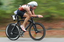
As for frothing at the mouth on th bike, sorry dude, it never happens, the harder the bike course the more I make those around me suffer - my problems and frothing at the mouth then begin once I start running hahaha
Hi! To me it seems like the total elevation is some +7000? What about that run course. Not sure that I ever want to get of that bike :)
Have you recived any confirmation about Korea yet?
Nicklas
Hi Nicklas, you're probably right but they told me they'd lost the altitude readings so although the pictures are official the actual altitude readings aren't yet (although I suspect they'll be similar).
I guess it'll be over 2000m for the bike which is going to hurt whichever way you look at it and I suspect that you'll be more than happy to get off the bike - it's leaving T2 that'll be the big question - haha
I'm not sure how you get 2000m for the bike course from looking at the graph it seems more like about 600-650m for 90km which is not too bad. Also I think the graph makes it look steeper than it really is as most of the hills look to be no more than 3-4% gradient which is not that steep. Of course I could be wrong and someone who knows the course please chime in but it looks more like a rolling course with two longer moderate grade inclines.
A, I sincerely hope you're right. I like rolling hills and that's what I trained for Ironman China. What you're suggesting is still going to add up to be a tough day in the saddle but hopefully not as bad as I was expecting. As you say it can be deceiving but hopefully the official numbers should be out soon or someone with a bit of local knowledge can help us.
As for the run, what's your take on that? Again it's difficult to fully comprehend from a graph but it looks pretty demanding to me. I've trained on a fairly hilly course and I've added some more hills in the last couple of weeks. Whichever way you look at it it's a hilly marathon after a hilly bike and a longish swim so it's gonna be tough whatever.
You have to remember that the bike course is 90km whereas the run course is 21km but they are both squeezed onto the same sized graph. If you stretched out the bike graph 4 times the hills would look much longer and less steep. Having said that it looks like a rolling up and down course which will make it a bit tougher and good to separate the draft packs.
For the run the first hill is about 100m climb over 3km so about 3% grade so that would be more of a long moderate incline rather than a steep hill - still will be tough on tired legs straight off the bike. The rest of the run course looks rolling up and down with nohting really steep but it will get harder as the legs get more tired especially the long grinders at 13km and 17km but then you get a nice 2km downhill run into the finish.
Would be great to have someone local confirm this for us though.
Hi!
I dont know - but it sure looks likes more then 600m x2.
Anyway - good luck!
There is no way 2000m. Dont take a road bike, take the TT. I have mapped it on Map May Ride and it is about 600m per lap as stated by someone else, and the hills are fairly low gradient.
If you are strong on the bike then a 12-27 is overkill.
A, Thanks buddy, all this feedback is really useful. I always intended to take my TT bike with Disc regardless of terrain. I have switched to a 27-12 but will also take a 23-12 and switch back if it makes more sense.
I have one more long ride on a hilly course and then that's that. If I've gone overkill on the hilly training then I don't think that can hurt too much.
My only other worry is the wind - I've been watching the weather and there have been some 40+kph windy days. So I may also take my rear trispoke as well as my disc to give me options.
Once again everyone, thanks for the feedback. Keep it coming if you have more to add.
Post a Comment